USDA to use NASA data for crop predictions
The US Department of Agriculture is using NASA data to monitor global croplands and make commodity forecasts.
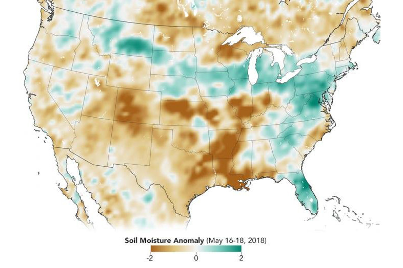
The Soil Moisture Active Passive mission, or SMAP, launched in 2015 has helped map the amount of water in soils worldwide. Now, with tools developed by a team at NASA’s Goddard Space Flight Center in Greenbelt, Maryland, SMAP soil moisture data is being incorporated into the Crop Explorer website of the USDA’s Foreign Agricultural Service, which reports on regional droughts, floods and crop forecasts.
Crop Explorer is a clearing house for global agricultural growing conditions, such as soil moisture, temperature, precipitation, vegetation health and more. With global coverage every 3 days, SMAP can provide the Crop Explorer tool with timely updates of the soil moisture conditions that are essential for assessments and forecasts of global crop productivity.
Variations in global agricultural productivity have tremendous economic, social and humanitarian consequences. Among the users of this new SMAP data are USDA regional crop analysts who need accurate soil moisture information to better monitor and predict these variations. Using the NASA data is more accurate than the computer models that USDA used before.
Source: NASA